Tuesday, March 25, 2014

Jeokbyeokgang Cliffs (Buan) (부안 적벽강)


A 1-kilometer walk north along the beach from the Chaeseokgang Cliffs brings you past Jukmak Village to the famed Jeokbyeokgang Cliffs. As you pass the village you’ll see a grove of silver magnolias (Natural Monument No. 123) that serve as a windbreak. The Jeokbyeokgang Cliffs stretch 2 kilometers from the village along the shoreline to Yongdusan Mountain and are said to resemble their namesake, the Jeokbyeokgang River in China.

Gyeokpo Beach (격포해변)


Gyeokpo Beach, located in Gyeokpo-ri, Byeonsan-myeon, Buan-gun in Jeollabuk-do Province, is part of the greater Byeonsanbando National Park. From the beach, visitors can get a close-up look at the rock formations of Chaeseokgang Cliffs. Known for its clear waters, the beach offers a splendid view of the west coast from the top of the cliffs and is considered one of the most beautiful beaches on the west coast along with Daecheon and Mallipo beaches.

Jusangjeolli Cliff of Mudeungsan Mountain (무등산 주상절리대)


The Jueangjeolli cliffs are rock pillars of various hexagonal shapes that seem as if they were hand carved. The Jusangjeolli cliffs of Mudeungsan Mountain consist of Seoseokdae, Ipseokdae, and Gyubong Rocks formed about 70 million years ago. Ipseokdae and Gyubong Rocks are both of a distinct pillar shape as they have been heavily weathered, and Seoseokdae, which was less weathered, looks like a folding screen. The Neodeolgeong (cluster of rocks), which sit on the mountain slope, were made when stone pillars collapsed. The standing rocks and Neodolgeong have been designated as Natural Monuments due to their rarity and uniqueness.

Jujeon Mongdol Beach (주전몽돌해변)


The beach from Jujeon to Gangdong is a big tourist destination in Ulsan. A small fishing village and gently rolling mountains rest in the back drop of this black pebble beach, one of the few in all of Korea. At night, the lights of fishing boats make quite a scene as they reflect against the water. This is a great area to dine on fresh seafood.

Jusangjeolli Cliff of Gangdong Hwaam Maeul Village (강동 화암 주상절리)


Jusangjeolli are columnar rock formations with cross sections in hexagonal or triangular shapes. The jusangjeolli at the shore of Hwaam Maeul Village were created by basalt lava that erupted in the Tertiary period of the Cenozoic Era about 20 million years ago. The columnar basalt formations were created as the lava cooled and shrank into cracks. The rocks look like wood stacked horizontally or vertically en masse. The length of the columns average around 20 meters and diagonally are about 50 centimeters at the longest cross-section. Of the columnar lava formations on the East Coast, the Jusangjeolli in Hwaam are the oldest, so it is academically invaluable. Shaped in various angles, the rocks also offer a great landscape for sightseeing.

Gray Whale Migration Site (울산 귀신고래 회유해면)


The Gray Whale Migration Site is a famous site for watching large gray whales, which usually appear during the months of December and January. They swim along the coast of Ulsan City, about 1-2 miles away from the land. The Site was officially designated as the National Natural Monument No.26 on December 3, 1962.

Yeonggeumjeong (영금정)


Yeonggeumjeong refers to the area covering the shore by the Sokcho Lighthouse in Sokcho-si City. The name Yeonggeumjeong comes from a notion that the sound of waves hitting the rocks is comparable to the melody of geomungo (traditional stringed instrument with 6 strings). At the end of the 50m-long bridge built over a rocky peninsula is a pavilion offering a view of the East Sea.

Yonghwa Beach (용화해변)


Spanning only 1㎞ in length, Yonghwa Beach, located 24㎞ from downtown Samcheok-si City, offers a serene atmosphere. Its half-moon shaped coastline, together with the strangely shaped rocks on both sides, creates a beautiful scenery, while its shallow water and low waves offer a perfect swimming location for families with children. Moreover, there is a stream that runs parallel to the beach, and a dense pine forest behind it.

Yeonpo Beach (연포해수욕장)


Located on the Taean Coast, Yeonpo Beach has been a desired vacation spot since 1972. The long stretch of curved sandy beach provides magnificent scenery. It is famous as the beach with the longest period of seasonal operation in the country thanks to its relatively high water temperature resulting from the warm currents. The pine groves and oddly shaped rocks along the coastline make for a fine view.

Baengnipo Beach (백리포해수욕장)


Baengnipo Beach is rather small beach but boats clean water and some of the finest sand on the West coast. There are beautiful cliffs at both ends of the beach adding to the natural beauty surrounding the beach. The groves of pine trees around the beach offer a great site for camping outdoors. The beach is well managed and offers services tailored to the needs of tourists, so visitor satisfaction is high.

Najeong Beach (나정해수욕장)


Najeong Beach is situated on the shores of the East Sea. The beach offers many convenience facilities and a seawater hot spring. The parking lot and pine tree forest by the hot spring are open to the public. Various leisure water sports are available in the area.

Gongam Rock - Elephant Rock (공암 - 코끼리바위)


Together with Gwaneumssanggul Cave and the Samseonam Rocks, Gongam Rock is one of the three scenic landscapes of Ulleungdo Island. The rock is in the shape of an elephant with its trunk dipped in the water for a drink. It is also called Gumeong Bawi (or Hole Rock) due to a 10-centimeter hole around the trunk. The surface of the rock looks like stacked firewood due to Jusangjeolli (columnar jointing) phenomenon.

Hupo Beach (후포해수욕장)


The 250 meter long Hupo Beach is situated right by Hupohang Port. The combination of an expansive sandy beach and indigo blue waters of the East Sea create a splendid view, drawing a large number of vacationers in the summer. 

Hupohang Port is the main receiving and distributing port for fish caught in the East Sea and in the early morning offers a great chance to not only see fish being hauled from boats to the fish market, but also to purchase fresh raw fish at an affordable price. In the hill north of the Hupo Beach stands the Hupo Lighthouse where one can get an open view of the East Sea and the Uljin area. Hupo Beach is one of the few beaches offering a splendid view of both the port and the lighthouse.

Woryeonggyo Bridge (월영교)


Opened in 2003, the Woryeonggyo Bridge (387m in length and 3.6m in width) is the longest pedestrian overpass made of wood in Korea. Woryeonggyo Bridge harbors a tragic yet beautiful legend about a wife who made a pair of Mituri (hemp shoes) out of her hair in heartfelt yearning and condolence for her late husband. In commemoration of her pure and noble love, the bridge was designed in the style of Mituri. At the center of the bridge is the Woryeongjeong Pavilion.

Gyeongjeong Beach (경정해수욕장)


Gyeongjeong Beach is famous for its serene and clean water with gentle waves. It is also used as an aqua farm for growing such marine products as sea cucumbers, abalones and sea squirts. The beach side road is a perfect driving course with the view of the horizon.

Cheongpodae Beach (청포대해수욕장)


Cheongpodae Beach is located in the coastal zone of Taean Coast National Park. It's gently curved shoreline, unique rock formations, pine trees, and migratory birds all combine to make one spectacular scenery. The sand is white, the waves are not too high, and the water temperature is just right — all these are reasons to make this the next family vacation destination.  Nearby beaches include Yeonpo BeachMongsanpo BeachBaeksajang BeachSambong Beach and Bangpo Beach.

Mongsanpo Beach (몽산포해수욕장)


Mongsanpo Beach, part of Taean Coast National Park, stretches 18km southwest of Seosan, 9km south of Taean and along the west coast of the Nammyeon Peninsula. Mongsanpo's white sand beach is around 3-km long and has a 5-degree tilt. The water is 1~2m deep with an average temperature of 22 degrees Celsius. 

The beach is surrounded by a dense forest of pine trees. The  pine tree forest along the beach serves as a good autocamp location to enjoy some fresh air and the natural beauty of the surroundings. During low tide, the muddy sediments deposited by the tide provide a place for children to learn about the world of creatures living on, in, and under the mudflats while catching clams and mud crabs at the same time. 

A 1km drive towards the western direction while passing throug the spectacular tree tunnel created by pine trees brings one to Mongdaepogu Port (몽대포구) where a number of fishing boats are docked. Near the port, one can find a number of small seafood eateries to enjoy some freshly sliced raw fish at reasonable prices.

Baeksajang Beach (백사장해수욕장)


Baeksajangpogu Port is located just 4km southwest of Anmyeondo Bridge, the bridge connecting the mainland with the island. Near the port is a white sand beach called Baeksajang. At Baeksajang Beach, the shimmering white sand stretches endlessly and the ebbing tide creates a different view of the horizon. Though the water level has a large tidal range, the beach's moderate water temperature make it a safe and enjoyable place to take a dip in even until late summer. 

The beach is 1.2km long and 300m wide and is made up of fine silica sand. Just around the corner is Sambong Beach. Baeksajang Beach is one of the major sources of jumbo shrimps and during autumn, crowds come to enjoy the taste of fresh jumbo shrimps. The beach even holds a prawn festival every fall when jumbo shrimp production peaks.

Dongmak Beach (강화 동막해변)


The primary attraction on the coastal road is the shore line of Dongmak Beach connecting Janghwa-ri in the town of Hwado-myeon (located south of Ganghwado Island) with Dongmak-ri. Visitors can comfortably enjoy the sunset after parking their cars on the roadside or in the parking lot of a nearby restaurant. Another great spot to enjoy the sunset is the high ground of Buno-ri. In Seokmodo Island, the best spots to enjoy the sunset are Minmeoru Beach and Janggu Neomeo Port. The beach of the island has a bow-like shape, and when the tide ebbs, a vast foreshore appears with all kinds of sea animals such as clams, crabs, trumpet shells, corb shells and more, making the island an excellent spot for children.

Jeju Olle Trail - Route 14 (Jeoji - Hallim Olle) (제주올레 14코스 (저지-한림))


Route 14 (19km) runs from Jeoji Community Center to the Biyangdo Island Hallimhang Harbor Ferry Dock. The trail passes through Sonang Forest, Mumyeongcheon Stream, a cactus habitat (seoninjang) in Wollyeong-ri, a Haenyeokong bean habitat, Ongpopogu Port, and Biyangdo Island. Hikers will pass through forest trails and rocky paths.

Sinpung Sincheon Bada Mokjang (Seaside Ranch) (신풍 신천 바다목장)


Jungsangangil Road stretches 14 km, and has a calm ambience. Old stone walls and dense trees line either side of the road. The road also leads to Seaside Ranch road (Bada Mokjang-gil (livestock ranch) which is open to pedestrians. The road is a unique location on Jeju, with expansive green fields located next to the ocean.

* 'Olle' means an extremely cramped alley coming to the main gate of a home from street in the Jeju Island Dialect.

Dombenang-gil Road (돔베낭길)


Starting at tea house "Solbit Bada" at Oedolgae Rock, the first section among the Jeju Olle trails - Route 7 passes through a seaside walking path, filming site "Daejanggeum" (대장금), Dombenang-gil Pathway and a sewage disposal plant in Hogeun-dong. 

The dombenang-gil Pathway stretches from Seoguipo Girl's Hight School in Seogwipo-si to Oedolgae Rock. Route 7 is a 13.9 km seaside road that includes Oedolgae Rock, Beophwanpogu Port, Jeju Poonglim Resort and Weolpyeongpogu Port. 

* 'Dombe' means a cutting board and 'Nang' means a tree.

Hwasun Golden Sand Beach (화순 금모래해변 (화순 해수욕장))


Hwasun Golden Sand Beach is surrounded by beautiful nature. It is close to Sanbangsan Mountain and the Yongmeori Coastline, and the islands of Hyeongjedo, Marado, and Gapado are off the coast to the southwest. On one side of the beach is a fresh water spring where people can enjoy a freshwater bath. 

The beach is located in Hwasun-ri in Andeok-myeon, which is easily accessible and has accommodations, shops, and restaurants.


※ Size - Length 250m, width 80m

Hamo Beach (하모해수욕장)


Hamo Beach is a 250 meter long and 100 meter wide sandy beach. Being the closest beach to Moseulpo, it is also called Moseulpo Beach. The sand is fine, the seawater is shallow, and there is also an expansive green field behind the beach for camping, so it is a great summer vacation destination for families. The beach is still relatively unknown to tourists, so visitors can enjoy a quiet atmosphere. They can also rent a fishing boat. Wild fish and turban shells can be had at inexpensive prices in nearby restaurants. 

Windy Hill (바람의 언덕)


On the way to Haegeumgang Village, one may encounter the fishing village of Dojangpo. On the left side of the village is Dojangpo Wharf, from where one can take a tour ferry to Oedo Island and Haegeumgang River. Looking up from here, one can see a hill covered in grass and overlooking the sea. This is Windy Hill.

A growing number visitors come to the place after it was used a filming site for popular Korean dramas such as Eve's Garden (2003, SBS) and Merry- Go-Round (2004, MBC). The name “Windy Hill” was given by those who visited the island and became a fan. Walking toward the hill along the wooden promenade from the wharf, one can see Hakdong Village from a distance. 

Baeksu Coastal Road (백수해안도로)


The Baeksu Coastal Road is National Highway 77 and Provincial Highway 14. It is one of the best drives in Jeollanam-do Province. Driving on this road, one encounters dynamically changing landscapes, including splendid rocks on along the coastal cliffs. The road is 16.5 kilometers long and gives a beautiful view of the Chilsan Sea. During sunset, beautiful colors along the west coast draw crowds of visitors all year round.

Mohang Beach (모항해수욕장)


Mohang Beach is situated in Mohang, Docheong-ri in Byeonsan-myeon. It is set against the beautiful mountains of Byeonsan Peninsula National Park and the clear waters of the west coast. With a nice sandy beach and a beautiful pine tree grove, the beach is a good summer spot for families. Designated a tourist site in December of 2000, the area has been equipped with a family hotel, family camp sites, beach cafes, recreation sites, camping sites, fishing grounds. Nearby, there are holly trees, a natural monument, a scenic driving course, and a seashore rock fishing ground.

Deokpo Beach (덕포해수욕장)


Deokpo Beach is a white sandy beach in the city of Geoje in Gyeongsangnam-do. The 450m-long and 40m-wide beach offers fine sand, clear waters, a gentle slope and old sea pine trees along the coast. The sound of the waves hitting the small pebbles, give a romantic atmosphere, especially at night. 

Nearby attractions include the Okpo Great Victory Commemorative Park, which was built in 1996 to commemorate the victory of Admiral Yi Sun-sin, and the Okpo Shipyard of Daewoo Shipbuilding & Marine Engineering with a giant shipyard crane.

Namwon Keuneong Promenade (남원 큰엉해안)


The word "eong" means "a hill" in the Jeju dialect. The name "Namwon Keuneong" means "a huge hill shaped like a mouth opened toward and ready to swallow up the sea." The flatlands on the cliffs are covered with soft green grass.

Visitors will be inspired by the area’s untouched nature and two naturally-made caves.

While walking along the seashore cliff, visitors will come across 2 km-walking path, an observatory, a simple resting place, a fishing site and restrooms.

Anmok Beach (안목해변)


Anmok Beach spans over 150 km in length and covers an area of 20,000㎡. The beach is often packed with families on a vacation. Right in front of the beach is Anmok Port, where around 23 fishing boats can be moored to unload their catch of seaweed in the spring; flatfish, squid, octopus in the summer; and sailfin sandfish, and pollack in the fall and winter. The place has also gotten more popular because of the coffee geori (coffee street) that sells coffee at reasonable prices.

Sacheon Beach (사천해변(사천해수욕장))


Nestled between Gyeongpodae Beach and Yeongok Beach, Sacheon Beach is a clean and quiet beach covering an area of 19,000㎡ and a length of 300m. The beach opened on July 1, 1975; because Gyeongpo Provincial Park is just nearby, many vacationers choose to come here during the holidays. Thick pine trees cover the area, and its clean white sand and shallow waters make this area an ideal place for rest and relaxation.

Gangmun Beach (강문해변)


Gangmun Beach has a number of hoetjip (raw fish restaurant) serving fresh raw fish supplied from Gangmun Port, a small port near the beach. Because of Gangmun Port, this area is abundant in fish regardless of the season. 

Well-organized accommodation facilities and the Gyeongpo district are also nearby. Tourists can explore the seascape and find anemone, big-sized fish species and other sea creatures by taking a 5-10 minute boat ride from the beach. This activity is popular among scuba diving clubs and the beach also offers a water-diving activity for couples. Fishing enthusiasts come here to catch minnows and yellowtails.

Beach area: 3,200㎡
Total length: 680m

Namhangjin Beach (남항진해변(남항진해수욕장))


Namhangjin Beach is a white sandy beach covering an area of 24,000㎡ and a length of 600m. 
Near the beach, there's a number of hoetjip (raw fish restaurant) with spacious parking lots. In addition, the dense pine tree forest and well-built accommodations add to appeal of this place.

Namhangjin Port is the where Seomseokcheon Stream meets Namdeacheon Stream. The name Namhangjin originated from an old port in Songjeong, which was located on a street leading south to Hansongsa Temple. 

Geojampo Beach (거잠포해변)


Geojampo Beach is surrounded by pine trees. The beach's blend of white sand and mud flats attracts many tourists and there are plans to develop the beach as an international vacation area.

Wangsan Beach (왕산해수욕장)


Though Wangsang Beach is just 5 minutes away from Eurwang-ri, the beach has quite a different ambiance compared to the Eurwang-ri area. While Eurwang-ri is more like a vacation spot for younger crowds, Wangsan as the relaxing charm of a fishing village. 

The view of the setting sun at Wangsan is one of eight scenic sites of Yongu.

Songnisan National Park (속리산국립공원)


Mt. Songnisan National Park is comprised of Mt. Songnisan and the valleys of Hwayang, Seonyu, and Ssanggok. Situated in the middle of the Sobaeksanmaek Mountains, which is the southwest branch of the Taebaeksanmaek Mountains, Mt. Songnisan is one of Korea’s most beautiful sites. The sharp granite peaks of Mt. Songnisan and the deep valleys of sedimentary rocks are spectacular. Therefore, Mt. Songnisan is also referred to as Mt. Sogeumgangsan, meaning a smaller version of Mt. Geumgangsan. 

One of Korea's largest temples, Beopjusa, can also be found on Mt. Songnisan. Uisang indicates a sitting Buddha statue and Maaeyeoraeuisang describes the Buddha sitting on a lotus flower. The years have damaged the figure quite a bit, but it still maintains its original beauty. Visitors to the temple will witness the Cheongdongmireukbul, which is the largest Buddha statue in the world. With its numerous treasures and National Monuments, Beopjusa Temple is the best place in which to experience the brilliant history of Buddhist civilization. 

Mt. Songnisan's deep valleys and the many Natural Monuments attract countless mountaineers and tourists. The cherry blossoms in the spring, green pine forest in the summer, and the lovely autumn leaves in the fall make this place beautiful all the year round.

Juwangsan National Park (주왕산국립공원)


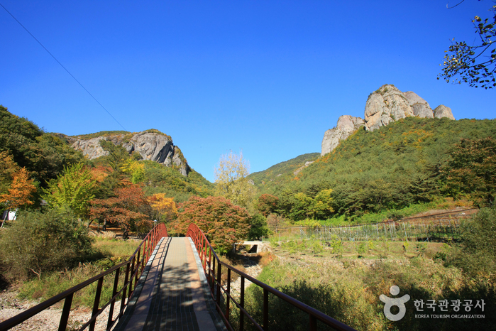
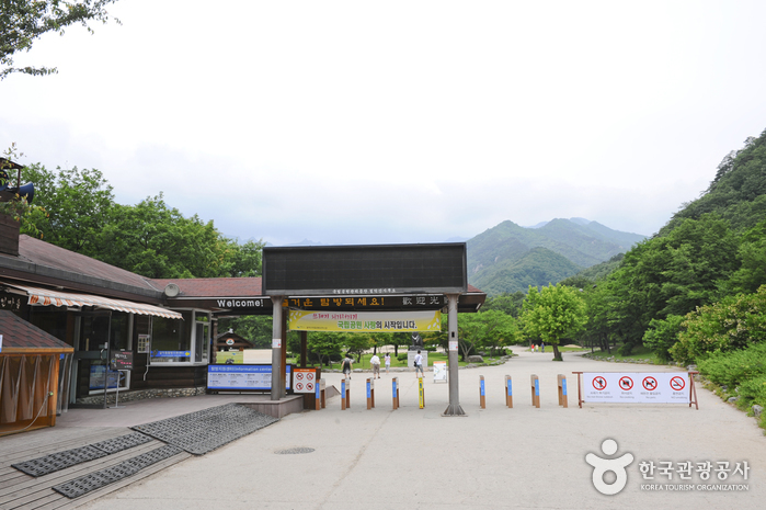
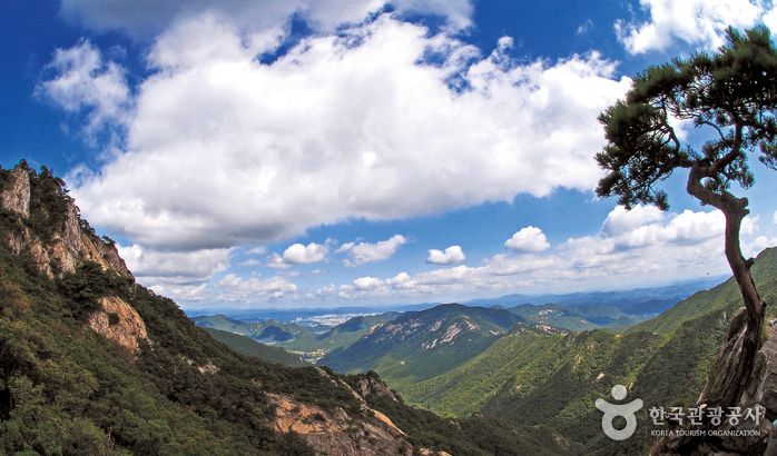
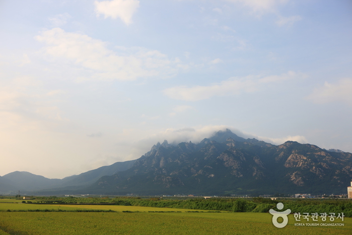
Mt. Juwangsan (721m), designated as National Park No.12 in 1976, is the smallest of the national parks in Korea. Mt. Juwangsan is not so steep, making it a great place to walk and enjoy the wonderful scenery. Mt. Juwangsan is also called Mt. Seokbyeongsan, Mt. Jubangsan and Mt. Daedunsan. There is a legend that King Juwon of Silla (57 B.C.-A.D. 935) lived on this mountain after turning Silla over to Goryeo. This is where it got its name 'Juwang'. There is another legend that General Mailseong of Goryeo assassinated King Wuju, who was living here, with arrows and iron hammer. 

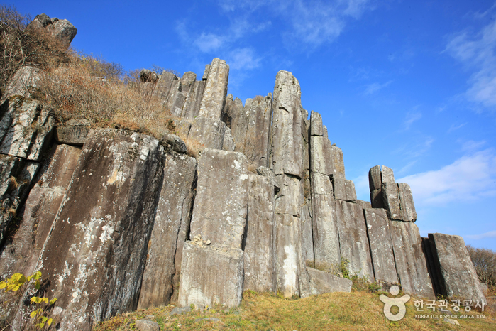
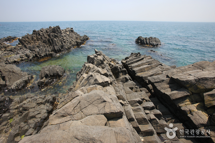
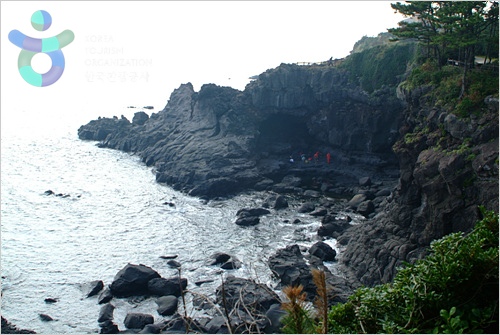
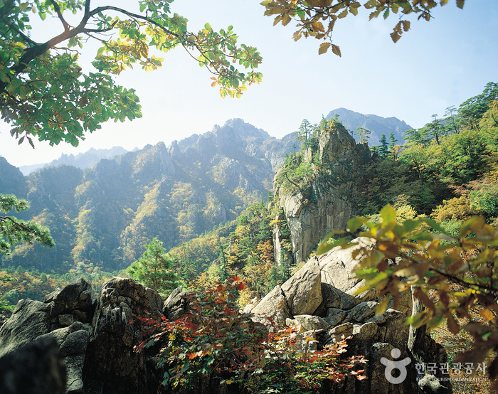
At Juwangsan, there are temples such as Daejeonsa, Gwangamsa, Yeonhwasa Temples, and hermitages such as Juwangam and Baengnyeonam. Daejeonsa Temple preserves national treasures such as the portrait of the Great Buddhist Monk Sa-Myeong, and the engraved wooden board personally made by General Lee Yeo-Song sent to the monk Sa-Myeong. In addition, You can find many interesting rocks such as Giam, Seokbyeokam, Geupsudae, Jeongsam & Adeulbawi, and also caves such as Juwanggul where Juwang hid before he was captured, Mujanggul where weapons were kept and Yeonhwagul, which used to be training grounds. 

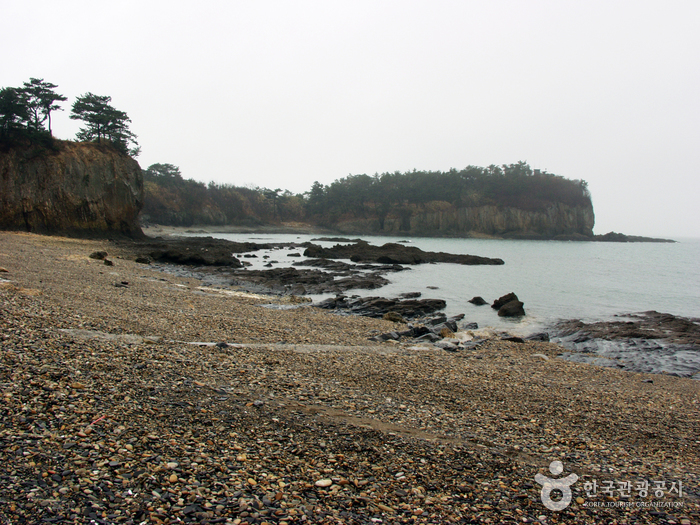
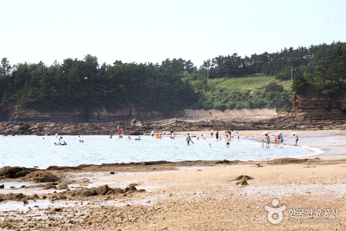
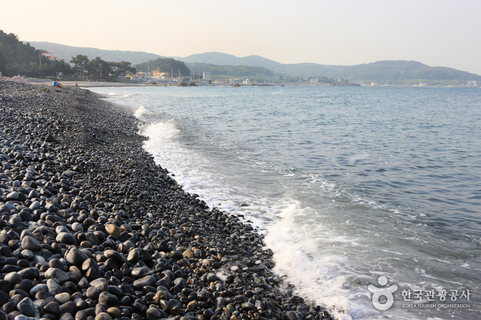
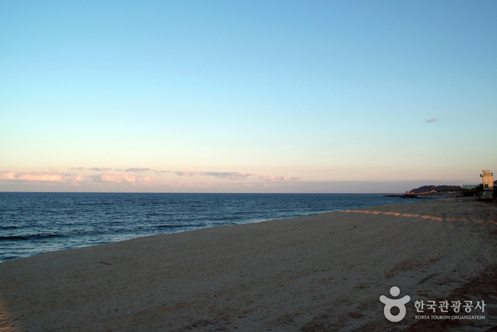
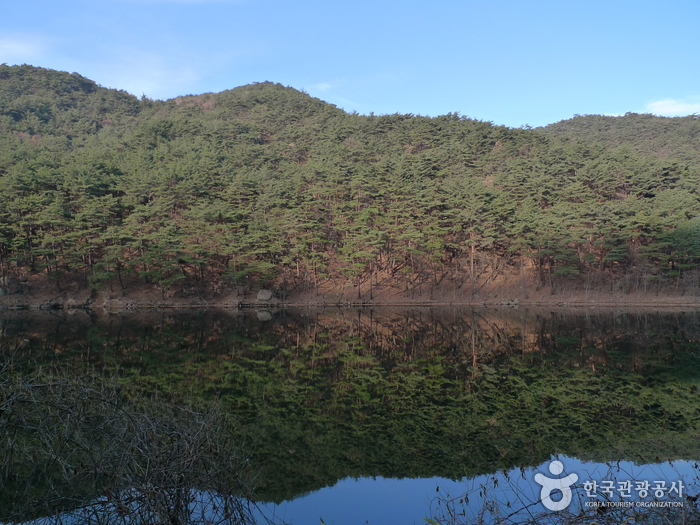
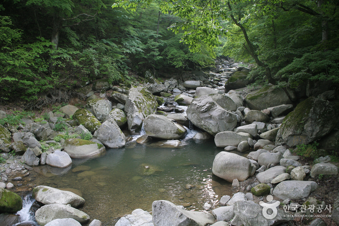
There are many waterfalls that represent the beauty of Juwangsan. The representative waterfalls are the 1st, 2nd, 3rd waterfalls and the Dalgi Pokpo Waterfall. Also there are many beautiful valleys such as the Outer-Juwang Valley, Inner-Juwang Valley, Woroe Valley and Naewon Valley. On the mountainside there is a 6 meter high Jahaseong Fortress that spreads out 15km, and there is the Dalgimul Mineral Spring in the Goenae mid-stream.

Sobaeksan National Park (소백산국립공원)


Sobaeksan National Park in South Korea is a branch of what could be called the backbone of Korea - Mt. Taebaeksan. In 1987, Mt. Sobaeksan was designated as National Park No.18. Its whole dimension is 320.50km. 

The features of Sobaeksan National Park in South Korea include The 320.50㎢ comprising Mt. Sobaeksan was designated as National Park No. 18 in 1987. There are many wild flowers and royal azaleas on Birobong Peak and the largest yew tree community is found on the northwest slope (1,200~1,350m above sea level) between Yeonhwabong Peak and Birobong Peak. 

The west of Mt. Sobaeksan is steep and streams from Nakdonggang River flow to Jukgyaecheon River, which is often used as a hiking course. Following down from Birobong Peak by Jukgyaecheon River is Seokryun Mine, and Choamsa Temple. If you proceed even further, you will get to Seokcheonpokpo Waterfall and Seonghyeolsa Temple. In this valley, there are mountain trouts that can only live in clean water. 

A 4km flat path to the southwest from Birobong Peak leads to Yeonhwabong Peak. There is the National Astronomical Observatory on the way to the second Yeonhwabong Peak from the 1st Yeonhwabong Peak, and a ridge called Jukryeong is on the south of the mountain. To the east of the second Yeonhwabong Peak, there are Huibangsa Temple and Birosa Temple built in the Silla Kingdom. Huibangpokpo Waterfall is considered the most beautiful waterfall of Gyeongsangnam-do Province, is at the entrance of Huibangsa Temple. 

Featuring the valleys and ridgelines, Mt. Sobaeksan National Park has breathtaking scenes and is known for its abundant wildlife and natural splendor.

Chiaksan National Park (치악산국립공원)


Chiaksan National Park (치악산국립공원) was designated as a national park in December 1984. For years Chiaksan has inspired hikers with its towering mountain sides and magnificent deep valleys. Its was once referred to as "Jeokak," but the name has since changed over time, due in large part to a mythical story. There once a man that rescued a pheasant from being eaten alive by a snake. When the man later found himself in danger, that pheasant saved his life in return. Because of this story the name became "Chiaksan." 

The temple connected to that story is Sangwonsa Temple. South of Sangwonsa Temple in Sangwon-gol is the Natural Monument Seonghwang Forest. To the west are Sejondae, Mangyeongdae and Mun Stone and Adeul (Son) stone. You can also see fortress walls from the myth of Jeonransa Temple such as Yeongwon Fortress, Haemi Fortress and Geumdu Fortress. Near the main peak Birobong is Seokgyeongsa Temple, where the soul of Ungok Won Cheon-Seok is said to be resting, and Ipseokdae, Sinseondae, Tejongdae and Nogoso. Behind them you can enjoy the magnificent landscape of Seryeom Waterfall, Sadari Byeongchang, Changde Rock and Tugubong Peak. 

Also on the top of Birobong are the famous three stone pagodas (10m high). Guryongsa Temple was established by Monk Uisang (625~702) of the Silla Kingdom (BC 57∼AD 935), during the reign of King Munmu. Other attractions include Daewungjeon (Local Tangible Cultural Property No.24), Guryong Waterfall, the Turtle Stone, Tiger Stone and Dragon stone nearby. 

For many years, Chiaksan was dotted with numerous temples. However, as time wore on, only Guryongsa Temple along with seven others remain today. At Guryong Valley there is a forest of pine trees that are hundreds of years old. The main ridges of Chiaksan are steep to the west but slope gently in the east.

Hallasan National Park [UNESCO World Heritage] (한라산국립공원 [유네스코 세계자연유산])


Hallasan (Halla Mountain) rises up proudly from the center of Jeju Island and is perhaps one of the island’s most memorable landmarks. Also called Mt. Yeongjusan, meaning ‘mountain high enough to pull the galaxy,’ Mt. Hallasan is widely acknowledged by scholars for its research value. Designated as a National Park in 1970, there are 368 parasitic mountains called ‘Oreums’ (peaks) around Halla Mountain. 

Mt. Hallasan is famous for its vertical ecosystem of plants that results from the varying temperatures along the mountainside. Over 1,800 kinds of plants and 4,000 species of animals (3,300 species of insects) have been identified; to explore the mountain's treasures, simply follow one of the well-developed mountain hiking trails. 

Hallasan Mountain is relatively easy to hike. With hiking courses less than 10km in length, it is possible to go to the peak and back in one day. However, the weather is very changeable and there is a lot of wind, so make sure that you are well prepared before you start climbing up the mountain. 

Hallasan Seongpanak (한라산 성판악)


Seongpanak is one of the parasitic volcanoes on Jeju-do island. Parasitic volcanoes are smaller volcanoes formed by lava bursting through the edge of the main volacano, and there are over 350 on Jeju-do Island. Seongpanak is 1,215m high and situated between Jocheon-eup, Bukjeju-gun and Namwon-eup, Namjeju-gun. The name came from the shape of the vertical cliff that spreads roughly 500 meters outward and resembles a fortress (seong) made of wooden boards (pan). 

With its thick verdant forest, Seongpanak has a unique atmosphere all year around. The road here is clear and wide, but a bit uncomfortable to walk because of many rocks. The azaleas create a pink blanket in the spring, and blends well with the clear waterfall in the area.

Jirisan National Park (Sancheong) (지리산국립공원 - 산청)


Boasting breathtaking views, Jirisan National Park was the first park in Korea to officially be designated a national park in 1967. Its glorious mountain range extends across three provinces and five cities. The magnificent mountains and exceptional scenery make this one of the most famous mountains in Korea. Roughly 1,915 meters above sea level, Cheonwangbong Peak, considered to be the pillar of heaven, is the main peak. Jirisan also features Banyabong and Nogodan, and is home to over 10 famous temples. There are over twenty summits and valleys such as Baemsagol Valley, which are part of "Jirisan Ten Sceneries." As this is the location of the most well-preserved virgin forests in Korea , the majestic and mystical mountain is highly revered. There are many species of animal and plant life, and as the first place to cultivate tea in Korea, herbal medicine cultivation still flourishes here. 

Jirisan Mountain was also where the Buddhist culture prospered, and there are many cultural assets here, such as Baekjangam Three-Story Stone Pagoda (National Treasure No.10), the Silsangsa Three-Story Stone Pagoda (Treasure No. 37) and more. These regional cultural assets and the superb sceneries of nature give you a unique taste of local history and culture. The weather is temperamental and only 80~100 days out of the year are clear and sunny, but the mist and fog create rare, unparalleled scenes not found anywhere else.

Seoraksan National Park (OeSeorak) (설악산국립공원 - 외설악)


Also referred to as Seolsan and Seolbongsan, the mountain was named Seorak ('Seol' meaning 'snow' and 'Ak' meaning 'big mountain') because the snow would not melt for a long time keeping the rocks in a permanent state of white. In November 1965, the Seorak Mountain district was designated as a Natural Monument preservation area. Afterwards in December 1973, it was designated as a park preservation area, and in August 1982, as a Biosphere Preservation District by UNESCO. 

The park is spread across 4 cities and counties: Sokcho, Inje, Goseong and Yangyang. The highest peak is Daecheongbong; to the east is OeSeorak and to the west is NaeSeorak, which is divided again into North NaeSeorak and South NaeSeorak. North NaeSeorak is composed of Bukcheon, which flows to Ingyecheon and Baekdamcheon streams. There are numerous valleys in NaeSeorak. Follow the Baekdamcheon valley where all the streams meet and you will reach Baekdamsa Temple, which is known for its beautiful scenery. Upstream there is Gayadong valley and Suryeomdong valley, and past Yeongsiam and Mangyeongdae there is Madeungryeong ridge (1,327m) that leads to Seorakdong. 

Follow Suryeomdong valley and you will reach Waryong and Ssangpok waterfalls. Further up is Bongjeongam (1,224m sea level). Once you arrive at Daecheong peak you can view the magnificent mountain range. The sunrise viewed from here is spectacular and should not be missed. South NaeSeorak directs the valley from Oknyeotang area to Hangyeryeong. Daeseung Waterfall north of Jangsudae is the most beautiful site of NaeSeorak, which is 88m high. South of Yongdaeri valley is the twelve fairy bathing spring, Oktang Falls, and Yongtang Falls, along with several other traditional relics.

Odaesan National Park (오대산국립공원)


Odaesan National Park (오대산국립공원) was designated as a national park in 1975. Its name was derived from the the following 5 plateaus: Manwoldae, Jangryeondae, Girindae, Sangsamdae and Jigongdae. Featuring the 1,563m high Birobong Peak, Odaesan spreads southwest with Mt. Sodaesan, Horyeongbong Peak and Mt. Sogyebangsan. The east side is connected with Sangwangbong Peak and Durobong Peak, which are over 1,000m high. 

The representative temple of Odaesan, Woljeongsa Temple, was named after the bright, full moon that rises above Manwoldae (Mt. Dongdaesan). At this temple the famous Octagon shaped 9-story pagoda (National Treasure No.48) and the Stone Seated Buddha Figure (Treasure No.139) is preserved. Also, Jeokmyeolbogung of Woljeongsa is where Monk Ja Jang preserved the Sakyamuni's noble relics. Inside Woljeongsa Temple, follow the fir trees 5 km east, and you will reach Sagoji where Yeonggamsa Temple stands. 

Odaesan has the largest natural woods of Korea. Many wild animals and plants are known to exist here. The area of Birobong Peak is famous for its Nuncheunkbaek and Yew tree forests. The royal azelea and Geumgang Chorong from Durobong Peak to Sangwangbong Peak are famous and there are animals such as boars, musk deer, turtledoves and colorful woodpeckers living here.

Seoraksan National Park (NaeSeorak) (설악산국립공원 - 내설악)


Also referred to as Seolsan and Seolbongsan, the mountain was named Seorak ('Seol' meaning 'snow' and 'Ak' meaning 'big mountain') because the snow would not melt for a long time keeping the rocks in a permanent state of white. In November 1965, the Seorak Mountain district was designated as a Natural Monument preservation area. Afterwards in December 1973, it was designated as a park preservation area, and in August 1982, as a Biosphere Preservation District by UNESCO. 

The park is spread across 4 cities and counties: Sokcho, Inje, Goseong and Yangyang. The highest peak is Daecheongbong; to the east is OeSeorak and to the west is NaeSeorak, which is divided again into North NaeSeorak and South NaeSeorak. North NaeSeorak is composed of Bukcheon, which flows to Ingyecheon and Baekdamcheon streams. There are numerous valleys in NaeSeorak. Follow the Baekdamcheon Valley where all the streams meet and you will reach Baekdamsa Temple, which is known for its beautiful scenery. Upstream there is Gayadong Valley and Suryeomdong Valley, and past Yeongsiam and Mangyeongdae there is Madeungryeong Ridge (1,327m) that leads to Seorakdong. 

Follow Suryeomdong Valley and you will reach Waryong and Ssangpok waterfalls . Further up is Bongjeongam (1,224m sea level). Once you arrive at Daecheong Peak you can view the magnificent mountain range. The sunrise viewed from here is spectacular and should not be missed. South NaeSeorak directs the valley from Oknyeotang area to Hangyeryeong. Daeseung Waterfall north of Jangsudae is the most beautiful site of NaeSeorak, which is 88m high. South of Yongdaeri Valley is the Twelve Fairy Bathing Spring, Oktang Falls, and Yongtang Falls, along with several other traditional relics.

Gayasan National Park (Hongnyudong,Cheongnyangdong Area) (가야산국립공원-홍류동,청량동지구)


Gayasan National Par...


Featuring the highest peak, Sanghwangbong, Mt. Gayasan is composed of many summits each over 1,000m in height. From the Taebaek Mountains, the Gayasan stretches from east to west. In 1972, it was designated as National Park No.9 due to its breathtaking scenery. 


Gayasan is know for its many tourist highlights, namely Haeinsa Temple, which is in the southwestern part of Gayasan. It is one of the three most famous temples in Korea. The Tripitaka Koreana (National Treasures No.32), consisting of over eighty thousand blocks, are found here. The place makes for fantastic scenery with the old temple and the beautiful landscape. 

In addition, there are other cultural properties such as Jangkyunggak (National Treasure No.52), Stone Buddha Figure (Treasures No. 518) Banya Temple Gyeongwangsa Monument (Treasures No.128) which was designated as a World Cultural Heritage by UNESCO. 

Moreover, Gayasan is noted for its graceful mountain landscape. The water flowing from Gayasan valley meets in front of Haeinsa Temple and flows to the southeast where it forms Gayacheon stream. Among the many valleys, Hongryudong valley (its water seems to turn red because of the leaves' autumnal tints) finishes the grandeur scenery with the several thousand year-old pine tree. Namsanjeil-bong, a peak located in southern part of Hongryudong, is called Mt. Cheonbulsan among Buddhists because it seems like thousands of Buddhist statues cover the mountain ridge. Mt. Cheonbulsan is a favorite one-day mountain climbing course for many. 

Gayasan shows magnificent landscapes every season with the cherry blossoms, azaleas and royal azaleas lined up on the road to Haeinsa Temple in Spring, the clean water and green trees in Summer, the glorious tints of its autumn foliage along the rock ridges in Autumn and a snowy landscape in Winter.

Gyeongju National Park (경주국립공원)


Gyeongju National Park is a bevy of cultural preserves dating back to the Silla Kingdom. 


Unlike the other parks located in the area, this park is segmented into individual districts. However, admission fee covers entry to the entire park because the districts are segmented for the government administration. Because Gyeongju itself is a historic city with many important historic sites and relics, Gyeongju is divided into 7 districts, and the park is divided accordingly. 

The Namsan area of Gyeongju is called the Namsan District. This is where many stone Buddhist statues, stone pagodas and about 100 temples sites are found. Here you can find Poseokjeong Pavillion, which was part of the living quarters the king had prepared outside of the palace for feasts. The Namsan District contains many relics spread about the area. You might feel like you took a ride on a time machine to a Buddhist temple of the past. 

Another district is the Tohamsan Mountain District. Here you will find the most famous tourist sites of Gyeongju, Bulguksa Temple. Bulguksa Temple was built in 535, during the reign of King Beopheung (514~540) of the Silla Kingdom and is located at the edge of Tohamsan Mountain. In front of Daeungjeon, there is Dabo Pagoda (10.4m high) to the east and the 3-story Seokga Pagoda (8.2m) to the west. These two pagodas are known as the most artistically constructed Korean stone pagodas, domestically and internationally. On the east side of Tohamsan Mountain is Seokguram, which is called the principal Korean Buddhist statuary. 

Within the Daebon District, a district of Gyeongju National Park, is King Munmu’s Sujungreung. Nearby the King Munmu’s Sujungreung Tomb there is the Gameunsaji 3-Story Stone Pagoda, which was built to honor King Munmu. 

In downtown Gyeongju there is a palace built on a half-moon shaped hill called Banwolseong and there is also the oldest stone relic in the east, called Cheomseongdae Observatory (9.2m high). Cheomseongdae Observatory was built and used as an astronomical observatory during the reign of Queen Seon-Deok (reigned 632~647). Between Cheomseongdae and Wolseong is the Gyerim Forest, where Kim Al-Ji (65~?), the progenitor of the Kim family, was born. The name Gyerim was also once used as the country name of Silla. 

Half a kilometer west of Cheomseongdae is Hwangnamdong where Jeonmachong is located. Anapji Pond, which was built to serve noble guests and where feasts were held, is also located in downtown Gyeongju. 

Gyeongju National Museum is located in Inwang-dong, Gyeongju, where the relics from 1,000 years of the Silla Kingdom are preserved.

Woraksan National Park (월악산국립공원)


The Woraksan Mountains are filled with valleys and beautiful waterfalls. Though the path to the peak of the Woraksan Mountain may be steep and rugged, once you’re up there, you are surrounded by Korean White Pine Trees and looking down on a stunning view of the lakes below. In wintertime the snow covered scenery of this National Park is breathtaking, and has been compared to Korea’s famous Geumgangsan Mountains. The park contains an abundance of wildlife and plants, many of which are extremely rare, so some hiking courses are regulated to prevent forest fires and ensure their protection. Within the park there are several traditional temples to visit and many attractions are located nearby, including the Suanbo hot springs.

Gyeryongsan National Park (계룡산국립공원)


Gyeryongsan National...


Gyeryongsan National Park stretches across Daejeon, Gongju, and Nonsan. This spectacular mountain is 845.1m above sea level and was made a national park in 1968. The origin of the word Gyeryong ('Gye' meaning 'chicken,' and 'Yong' meaning 'dragon') comes from the fact that the ridgeline looks like a dragon wearing a chicken's crest on its head. The topographical features are what make this mountain stand out and its mysterious folklore is what makes it so interesting. There are 15 summits on this mountain, of which Cheonhwangbong (845.1m) is the main. Several others include the peaks of Sambulbong, Sinseongbong, and Gwaneumbong. This mountain is famous for its many interesting sites, with its fantastic rock structures, on the west side the Yongmun Waterfall, to the east Eunseon Waterfall, and to the south Amyongchu and Sutyongchu Waterfalls. 


In the spring, cherry blossoms bloom on Donghaksa Mountain trail, and during the summer the lush green of the Donghaksa Valley is very beautiful. During the fall, the maple trees reveal their crimson colored leaves around Gapsa Temple and Yongmun Waterfall. And the snowcapped peaks of Sambulbong in the winter are simply breathtaking. 

Gyeryongsan is full of rare animals and plants, beautiful waterfalls and a rich history with mysterious legends and cultural treasures. To the east is Donghaksa Temple; northwest, Gapsa Temple; southwest, Sinwonsa Temple; and southeast, Yonghwasa Temple. Its valleys are full of ponds and falls that blend together perfectly with the surroundings.

Wolchulsan National Park (월출산국립공원)


Mt. Wolchulsan National Park is located in the southern part of Korea. The name Wolchulsan appropriately denotes "mountain where the moon rises". Starting with the Cheonhwangbong Peak (809m) at the center, the whole area is filled with rocky mountain peaks which all look special and unique. 


Walk for about 20 minutes past the National Park's parking lot and Dogapsa Temple, and the entrance to Weolchulsan comes in to view. About 5km beyond the gate, you can see Gujeolbong Peak, shaped like nine large pots. Because this place always has water, it is said that a dragon used to live here. Another 500m further down you can see Maaeyeoraejwasang, the sitting Buddha statue, which is designated as National Treasure No. 144. Just beyond the statue a path leading to the top is filled with lush green forests. 

When you get to the top of Mt. Wolchulsan, there is a large flat granite rock that can fit up to 300 people. Staring down from here gives you a great view of Mt. Wolchulsan. Climbing down from the top, you can cross the arched bridge, 120m from the ground, 52m long, and 6m wide. It takes a bit of courage to walk across this bridge. To the left of Sajabong Peak, around the middle of the mountain, there is a waterfall pouring down into the valley as seven separate falls on top of each other, called Chilchi Waterfall. 

On the way down to Dogapsa and Muwisa Temples, there is a field of reeds by the road that becomes spectacularly beautiful during fall. The sunset in the west is also beautiful beyond description. In the spring, the azaleas, in the summer the cool waterfalls, in the fall, all kinds of lovely colors, and in the winter, the snow covered mountains and valleys – Wolchulsan National Park is truly a wonderful site to visit all year around.