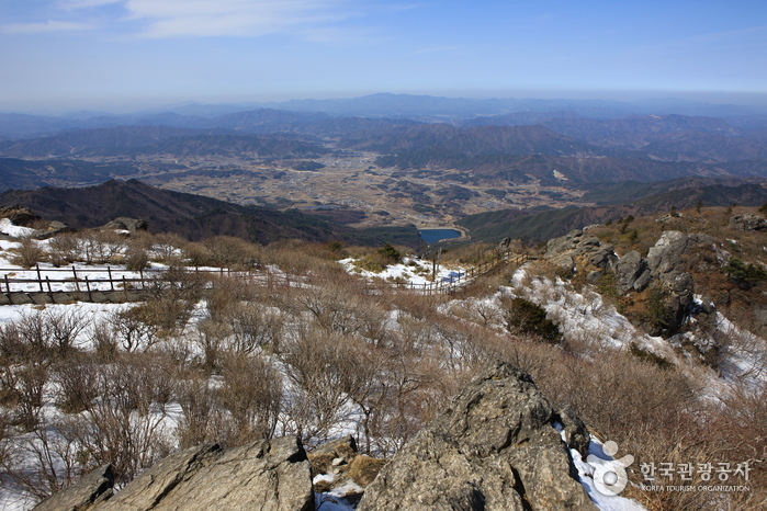
Deogyusan National Park covers Geochang-gun of Gyeongsangnam-do and Muju-gun of Jeollabuk-do. Starting from Mt. Deogyusan's main peak, Hyangjeokbong, the ridges are about 1300m above sea level, and as it stretches southwestward for about 18km, it branches out in many directions to create a long series of mountains. For every branch of the mountain ridgeline, there are matching valleys at Mt. Deogyusan.
Among these valleys, Mujugucheondong Valley, stretching 25km from the Deogyu peak to Seolcheon River on the north, is the most famous. There are 33 wonderful scenes in the valley that are praised for their beauty, called Gucheondong 33 Kyeong. Susimdae is a valley 400m deep. Because water as clear as jade flows through here, it is also referred to as Suhwa.
Deogyusan also has three valleys that are grouped together: the Chilyeon, Jeoksang, and Munan. Among them the Chilyeon Valley is the most beautiful. It is famous for its Chilyeon Waterfall, where clear water passes by thick pine forest and winds through a series of rock formations. This water current has created seven ponds, and the way they are all lined up makes up for a very interesting view. Clear water circulates into each of these ponds, and then flows into another pond to create a series of seven segmented waterfalls. The Chilyeon Waterfall complements the surrounding old pine trees and maple trees. In the summer, many vacationers, and in the fall, people looking for autumn colored leaves visit this area.
Mt. Deogyusan has many beautiful valleys, waterfalls, pine forests, and intresting rock formations. Mujugucheon-dong local officials, in conjunction with the National Park Administration Office, provide visitors with many convenient facilities in order to make for a pleasurable stay.
No comments:
Post a Comment